Proposed development of Chieveley Quarry
About our proposals
The proposed site is located immediately to the east of the Chieveley Motorway Services Area off junction 13 of the M4 motorway and the A34 road. The site is approximately 1 km south of the village of Chieveley and approximately 0.5km southeast from the village of Curridge. The development area covers approximately 12 hectares (29 acres) and comprises a field of mainly arable land.
It is proposed to extract circa 500,000 tonnes of soft sand over a period of 10 years on a phased basis and to restore the site to agriculture at original ground level using inert materials including soils and clays from foundation works at construction sites.
Historically, since late 90s to approximately 2013, Grundon extracted mineral from the site located almost immediately to the north-east of the proposed new quarry. The former quarry site, referred to as Old Kiln Quarry, has been restored and formally signed off the aftercare period in December 2021.
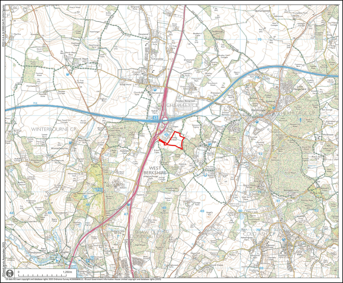
Site Location Plan
The local need for aggregates
Aggregates are used to build and maintain our houses, offices, roads, schools and hospitals. They provide a firm foundation for our railways, are used to construct factories, warehouses and shops, and can protect us against flooding.


They are essential materials for the construction industry, an important sector of the economy. Without them the many infrastructure projects, that bring huge benefits to the country, could not be built.
The growth of a modern economy is likely to be directly linked to the quality of its infrastructure. The construction industry is an essential component of this infrastructure provision and aggregates are a vital raw material for this industry.
The Government’s recent reintroduction of mandatory planning targets with the aim of delivering 1.5 million new homes over the next five years will place significant pressure on demand for building materials.
Therefore, an adequate and reliable supply of aggregates is essential.
The main markets for soft sand produced within West Berkshire are sales of dry-screened (unwashed) sand to local builders and to builder’s merchants within the area. The sand is used primarily in mortar for brick-laying and masonry work.
Minerals planning policy
Under the National Planning Policy Framework, Mineral Planning Authorities are required to provide for a minimum 7-year supply of sand and gravel, including soft sand. The landbank for soft sand in West Berkshire is currently zero with the last site closing in 2019. West Berkshire is currently reliant on other Counties for supply of soft sand with no guarantee that this will continue, resulting in higher building costs.
West Berkshire Council (WBC) has a legal responsibility to make sure it facilitates delivery of the right materials, at the right time in the right place. This is done through the Minerals and Waste Local Plan (MWLP).
Following extensive consultation and examination by an independent inspector, the Chieveley Services proposed site was allocated in the MWLP to ensure a steady and adequate supply of construction aggregates. Policy 31 of the plan sets out the requirements and considerations which need to be assessed in any planning application for mineral extraction.
It is a requirement that applications, such as for new minerals sites, are accompanied by environmental reports that evaluate any potential impacts, mitigation measures and cumulative impacts on the wider environment. Our application will be accompanied by such assessments.
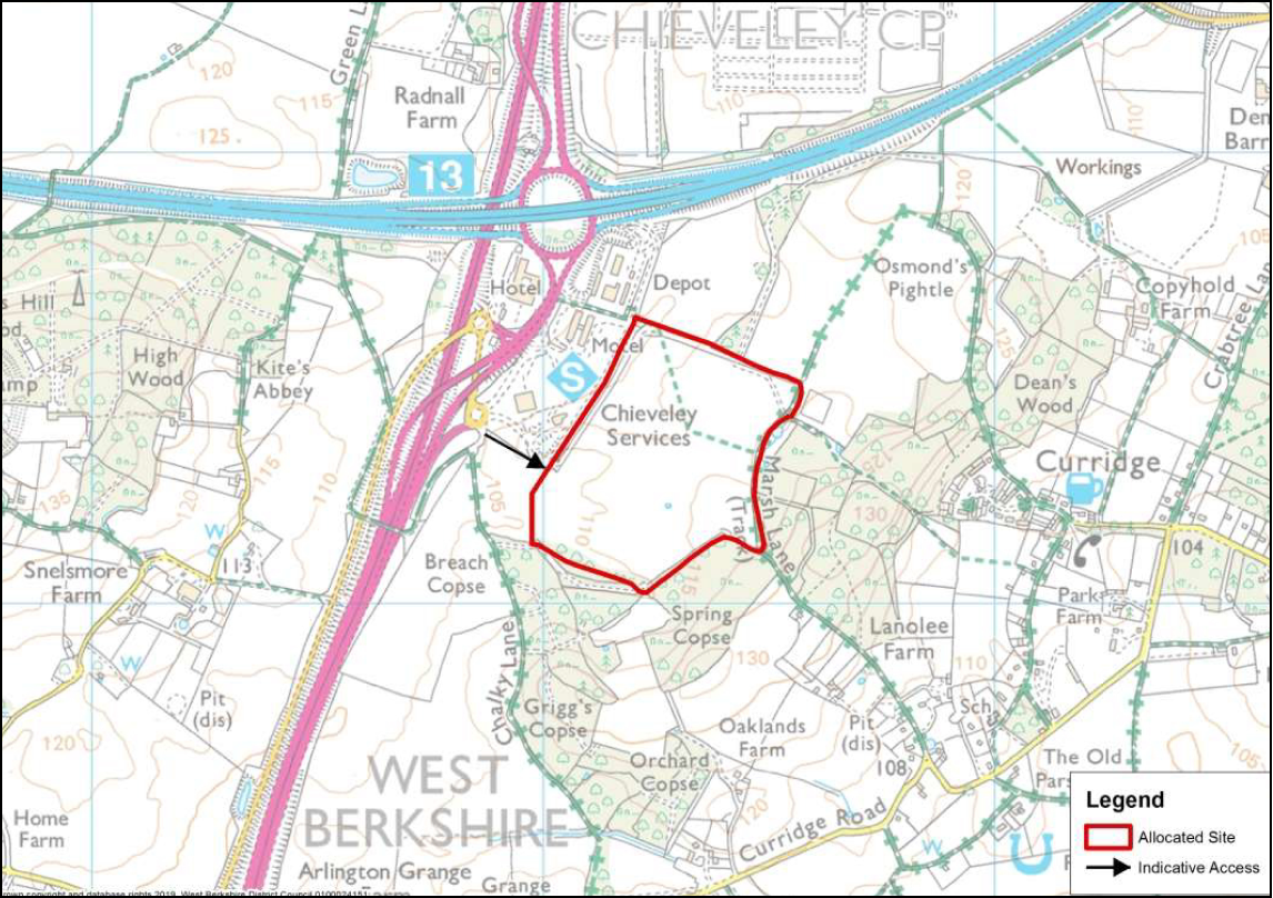
Chieveley Service Site Allocation Plan
Mineral reserves and geology
The site is underlain by the Lambeth Group and Seaford Chalk Formation. The Lambeth Group (the sandy layer) is described on the British Geological Survey maps as clay, orange, brown and grey, with beds of fine-grained sand, yellow to brown. It is this formation within which the soft sand proposed to be extracted lies. It is located in a layer 7 – 13 metres deep across the site.
‘Soft sand’ is generally fine-grained sand in which the individual grains are wellrounded, imparting a relatively soft texture and free-flowing nature to the sand.
The characteristics of such sands lend themselves especially to products which are required to ‘flow’ or be easily ‘workable’ by hand when they are being used – particularly mortars, but also plaster, in the case of very fine-grained sand. These are collectively known as building sands.
Following site investigations, it is estimated that there is approximately 500,000 tonnes of soft sand available for extraction at the site.
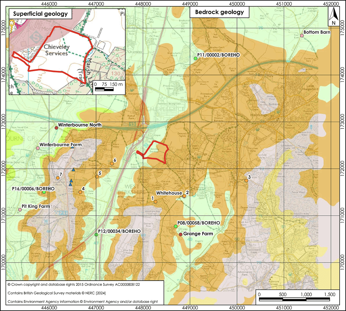
Geology overview
Proposed site operations
With the site investigations largely complete, we started to develop our scheme.
Main design considerations include:
- minimising visual and amenity impact within the North Wessex Downs National Landscape
- minimizing impact on public amenity and residential properties
safeguarding ecology and protected species; enhancing biodiversity - maintaining ongoing right of way access and use
- highways safety
- protection of groundwater resources
Assessing these constraints has resulted in the following proposals:
- phased working so that only one phase is being extracted at any one time, with the preceding phase being restored back to agriculture. Areas awaiting extraction will remain in agricultural use where possible.
- reducing the potential sand extraction area from 22.2hectares (as proposed in the Minerals and Waste Local Plan Site Allocation) to 12 hectares to reduce potential impact on landscape and visual amenity.
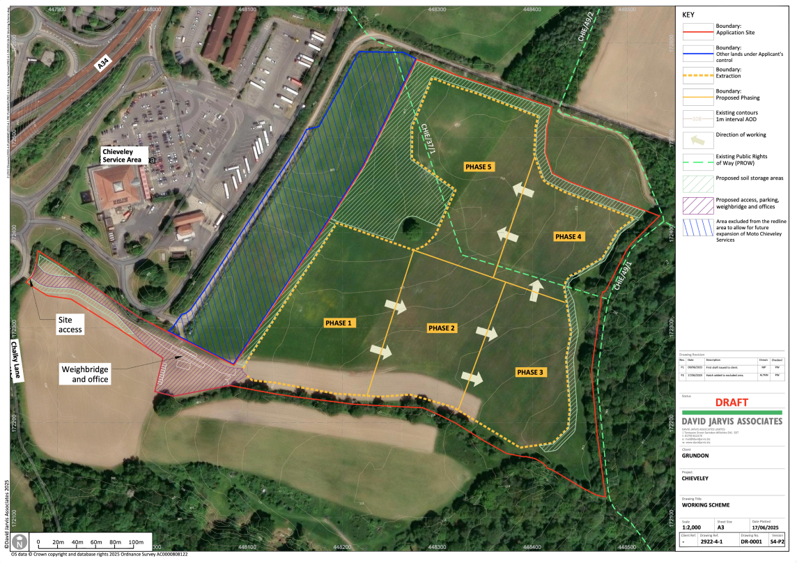
Existing Conditions & Proposed Phasing (site operations)
The site is expected to provide 500,000 tonnes of sand worked over 10 years over 5 individual phased areas. Approximately 50,000 tonnes of sand is proposed to be extracted annually.
Land not immediately required would remain in agricultural use where possible until needed for extraction.
Only one phase would be worked at any time, with each phase size being between 1 and 2 hectares, and the largest phase being the size of 2 football pitches.
Progressive extraction is undertaken on a phase-by-phase basis, with each phase worked and then restored the following year.
Initial operations consist of the construction of a new access, a vehicle weighbridge, parking, office and equipment storage compound area, upgrading of the electrical supply and the preparation of Phase 1 for extraction.
The direction of working is anticlockwise starting next to the site office/weighbridge area moving east along the southern side before moving westwards in phases 4 and 5.
As extraction is completed on a phase-by-phase basis, restoration of the preceding phase will be undertaken using inert infill to follow the same direction as extraction.
Restoration would be back to agricultural use with areas of ecological enhancement such as areas of scrub or field margins.
Access to the site will be provided by upgrading the existing field access off Chalky Lane, allowing vehicles access straight onto the A34 and M4.
Methods of working
Initial Works
Prior to any works taking place, any ecological mitigation work that is required will be undertaken. Fencing will be erected where necessary including around the trees to be retained on site.
Work would start with the formalising and widening of the existing access and construction of the access road and site compound/parking area. The compound would include a vehicle weighbridge, office, staff welfare facilities and staff/plant parking.
Soils would be stripped from phase 1 extraction area using an excavator and dump trucks and used as temporary screening bunds 3 – 5 metres high around the site or stored in the soil storage area.
Extraction
Following soil stripping of phase 1, sand will be extracted using an excavator. A mobile dry screening plant will be used to screen the sand before it is loaded into Heavy Goods Vehicles (HGVs) using a wheeled loading shovel and transported off site via the weighbridge. The screening plant is typically 5 metres in height and is powered by electricity. The screening plant is designed to remove any stones, clays or soils. Any non-saleable material will be used in the restoration of the site.
As extraction comes to an end in phase 1, soil stripping will commence in phase 2. The remaining phases will be worked in a similarp manner.
Working Scheme
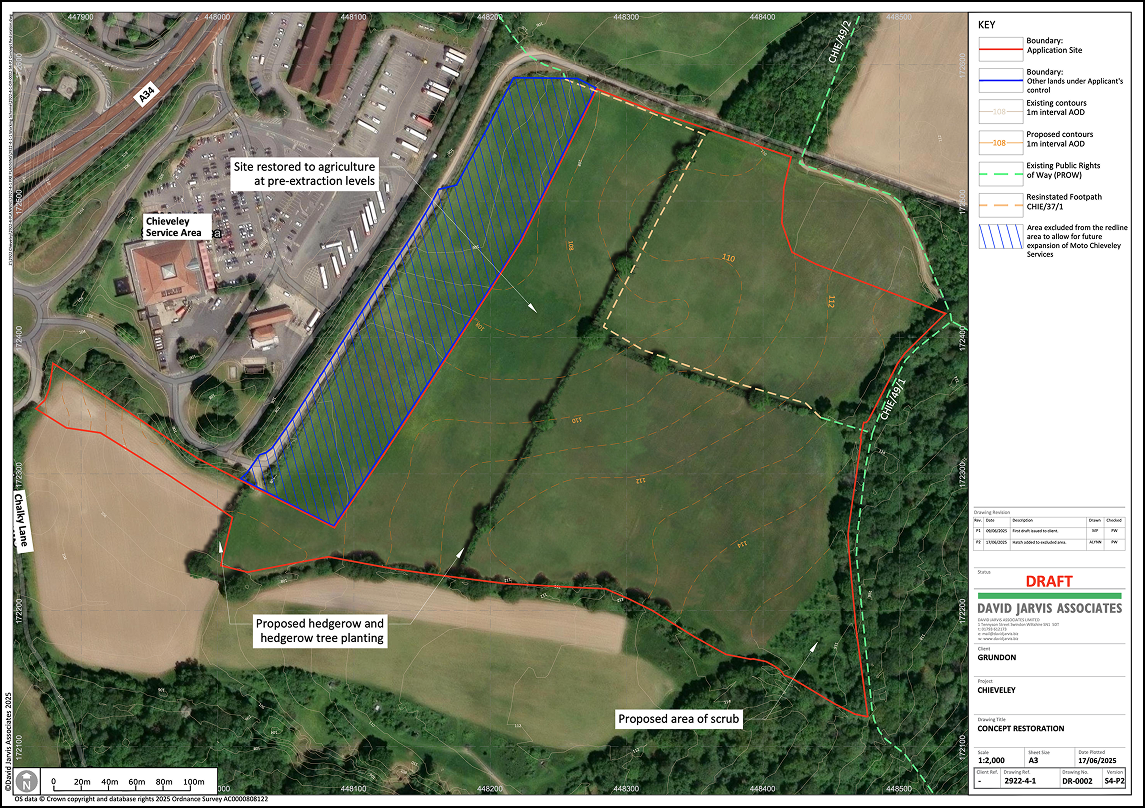
Restoration proposals
Due to the high-grade classification of the agricultural land, the site will be restored back to agricultural use along with ecological enhancement areas such as areas of scrub and field margins.
The final restoration plan will include new tree and hedge planting whilst maintaining existing trees where possible throughout the lifetime of the proposed development.
The site will be progressively restored back to existing ground levels using imported inert excavation material (clays and subsoils) from construction projects and waste material from the extraction process to achieve the final restoration levels. The use of inert infill material for restoration will be controlled by an Environment Agency permit.
Inert infill material is brought to the tipping area by HGVs and moved into position using a bulldozer. Restoration involving the replacement of soils will be carried out using appropriate equipment in accordance with best practice to ensure the site can be farmed successfully afterwards.
Grundon operates to the standards of PAS 99 Integrated Management System together with BS ISO 9001:2015 (Quality Management), BS ISO 14001:2015 (Environmental Management), BS OHSAS 45001:2018 (Occupational Health & Safety Management).
Each site is subject to auditing to ensure compliance. The Minerals Planning Authority (in this case West Berkshire Council) are also required to carry out planning compliance visits to monitor the site, usually three times per year, and to report any issues to elected members.
As with Grundon’s other operational quarries, we propose setting up a local liaison group for the Chieveley site which will be chaired by a local Councillor with the remaining members being elected representatives from the Parish Council, officers from the Council and Grundon. The liaison group principle objective is to enable discussions on progress, share any concerns and share information on future activities. We find these work well in establishing a working relationship with key stakeholders.
Concept Restoration
Traffic management
Site operations are usually between 7.00am to 5.00pm Monday to Friday with occasional Saturday mornings 7.00am to 1.00pm, There is no working on Sundays or Bank Holidays.
Due to the small scale of the proposed quarry, daily HGV movements would be, on average, 48 movements (24, in 24 out) at the peak of operations when excavation and infilling are taking place at the same time. As the site is well connected directly onto the A34/M4 junction, these HGVs would not travel through any local towns or villages to access the site, unless delivering or removing material from local projects.
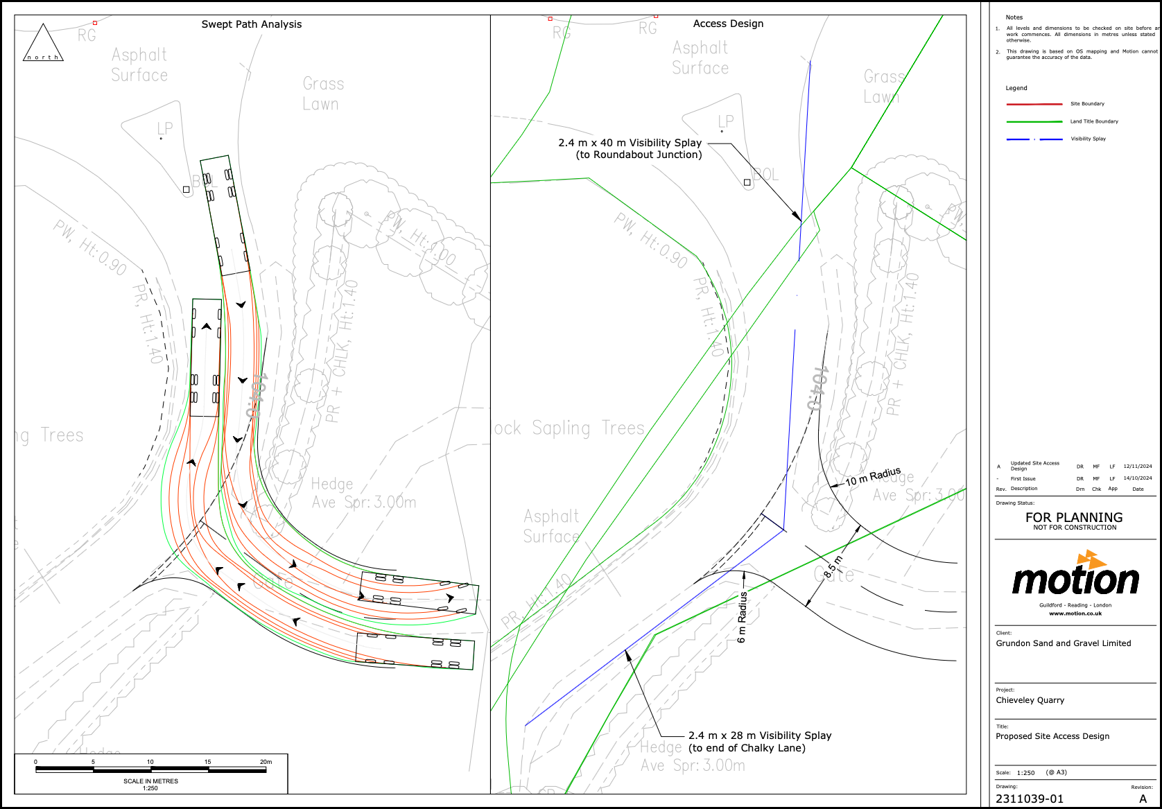
Proposed Site Access Design (indicative)
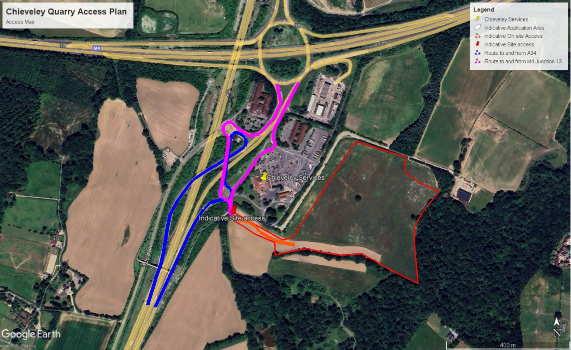
Chieveley Quarry Access Plan
Ecology and Biodiversity
A range of ecological surveys have been or are currently being undertaken at the site. These include bat activity surveys, great crested newt surveys (eDNA and population class size assessment), reptile surveys, non-breeding and breeding bird surveys. These surveys will inform the final scheme design, phasing and restoration proposals. Where necessary, mitigation measures may be recommended by the project ecologists to ensure no harm is caused by the proposed development.
A Biodiversity Impact Assessment will accompany the planning application which will demonstrate how the site will achieve a biodiversity net gain of more than 10% as required by the Environment Act 2021.
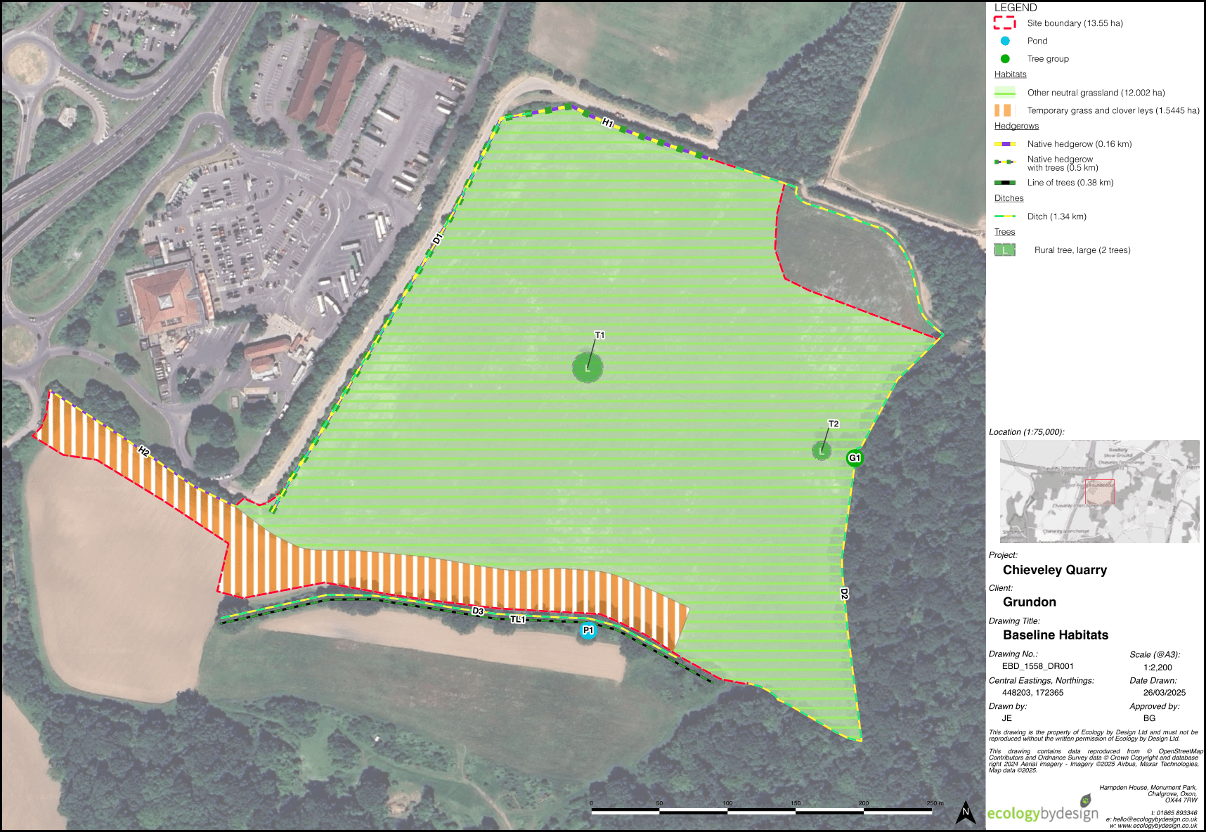
Ecology and Biodiversity – Baseline Habitats
Archaeology and Cultural Heritage
The site has been historically subject to various stages of archaeological assessment and evaluation which have shown that there is little of archaeological interest on this site. However, in a small area towards the centre of the proposed workings some limited evidence for Iron Age activity was recovered.
The investigations have been reviewed by the Council archaeologist and they have advised that an archaeology watching brief should be employed during soil removal.
An assessment of any effects on listed buildings, conservation areas or other heritage assets in the surrounding area will form part of the Environmental Impact Assessment.
Hydrology
Groundwater levels and quality are monitored around the site by Grundon and this would continue throughout the development and operations of the quarry.
The site is located outside of any areas likely to flood.
A Hydrological Impact Assessment and Flood Risk Assessment have been undertaken to assess the impact of the proposed development on the water environment.
As all works will take place above the water table there is limited risk to groundwater levels or groundwater quality. There will be no requirement to dewater the site (pump water out to a stream or river). Material used to restore the quarry will be inert and will be controlled by strict Waste Acceptance Criteria (WAC) and procedures. This process will prevent any chemically unsuitable material being placed at the site.
During operations, all surface water run-off will be directed to the quarry void and soak away naturally. Following restoration, the site’s surface water run-off regime is anticipated to return to as it was prior to minerals operations, with no increase in run-off rates.
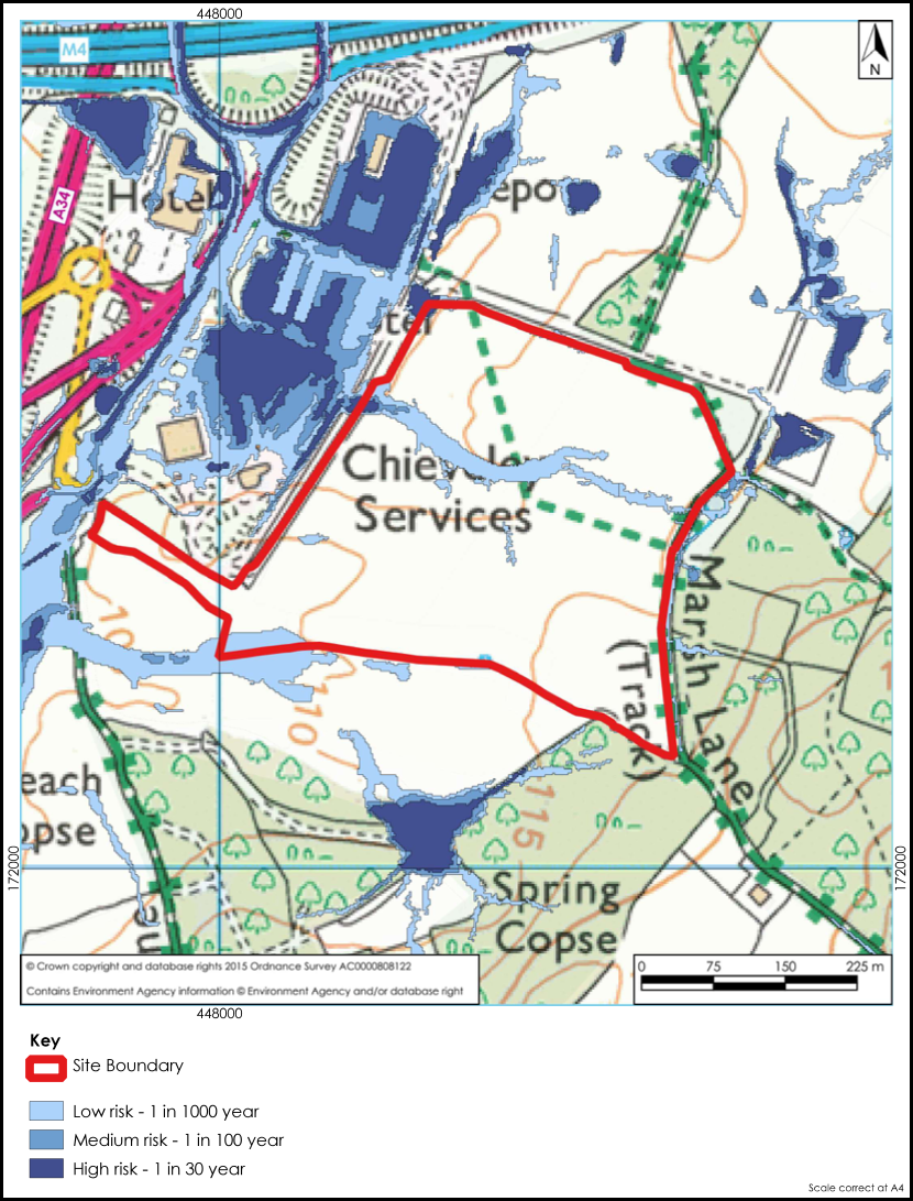
Hydrology surface water flood risk
Landscape and visual impact
The site is located within a designated landscape (the North Wessex Downs National Landscape). This has been taken into consideration when designing the scheme. The phased approach to extraction and progressive restoration aims to minimise the impact on landscape and visual amenity.
The planning application will be accompanied by a Landscape and Visual Impact Assessment which will assess the impact on the proposed development on local landscape character and potential impact on various viewpoints and receptors in the surrounding area.
Closer to the site, works will take place at a lower land level and be screened by soil storage bunds which will be seeded with a suitable grass seed mix.
Phasing is designed to minimise visual impact by reducing the area in use at any one time.
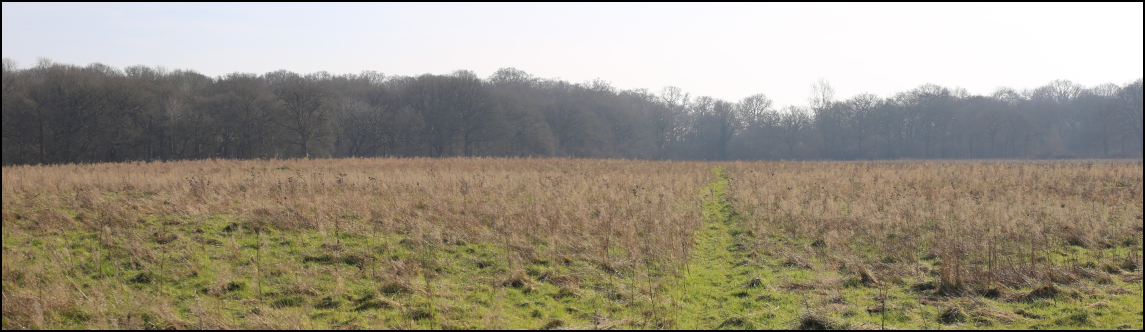
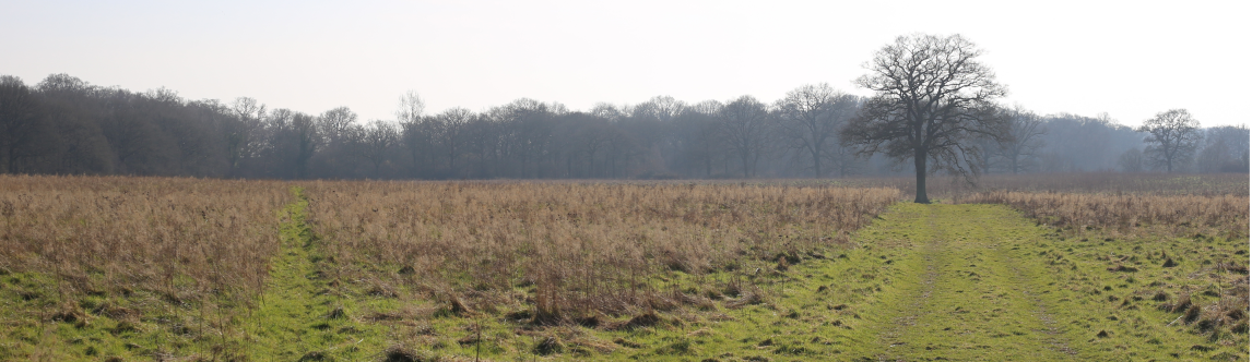
Views across the site
Public access
In order to facilitate the proposed development, it will be necessary to temporarily divert the footpath (Ref. CHIE/37/1) that crosses through the northern half of the site along the northern site boundary.
Noise and dust management
Noise and dust management would comply with current Government guidance and would be controlled by planning conditions. Regular monitoring would be carried out and recorded by Grundon and West Berkshire Council.
Noise levels would be kept to a minimum with the use of electric equipment where possible. Working at a lower land level with soil screens and using one-way vehicle routes to eliminate reversing and the need for warning alarm systems will also help minimise noise.
Dust would be minimised through good housekeeping, such as on-site speed restrictions, road sweeping and using a water bowser to dampen any internal haul roads. Other measures including cessation of extraction during high winds if necessary.
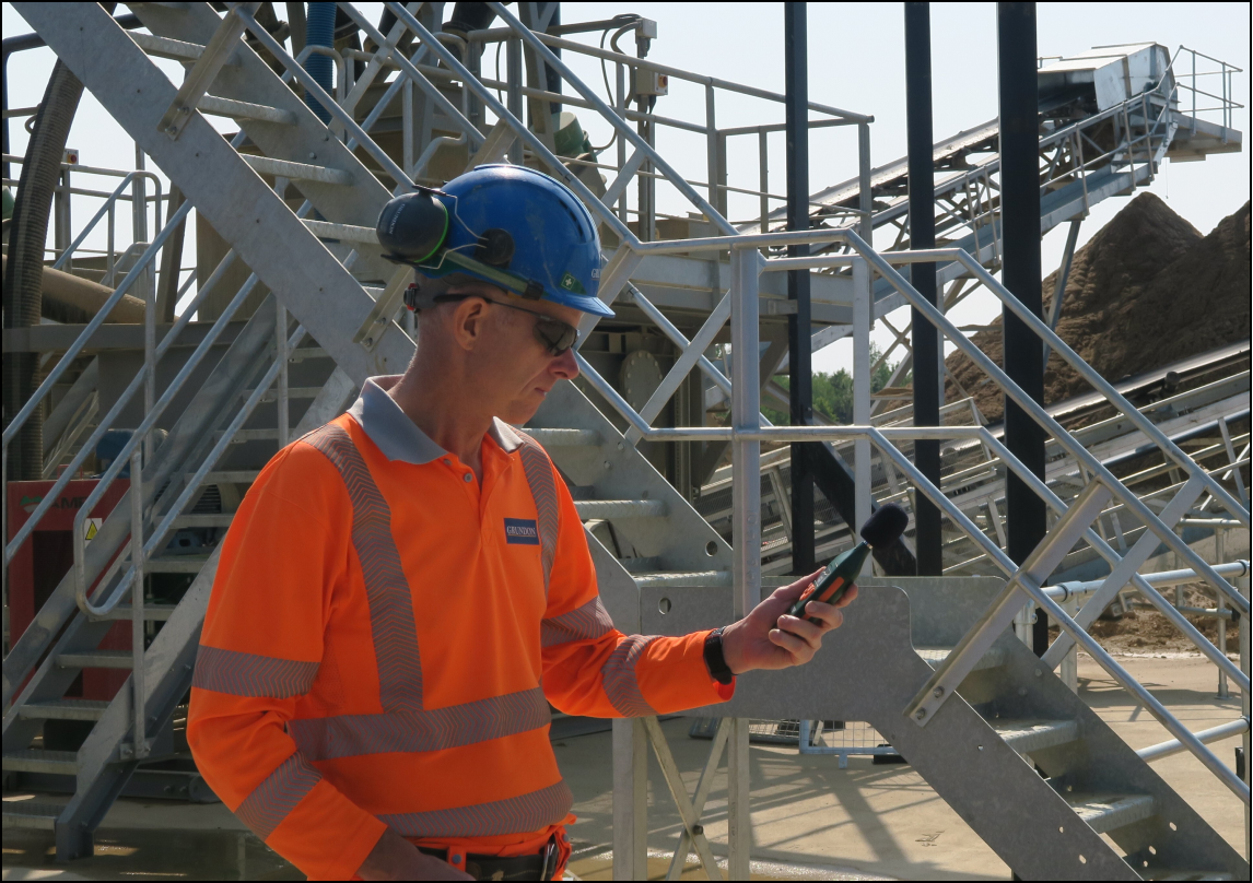
Noise monitor